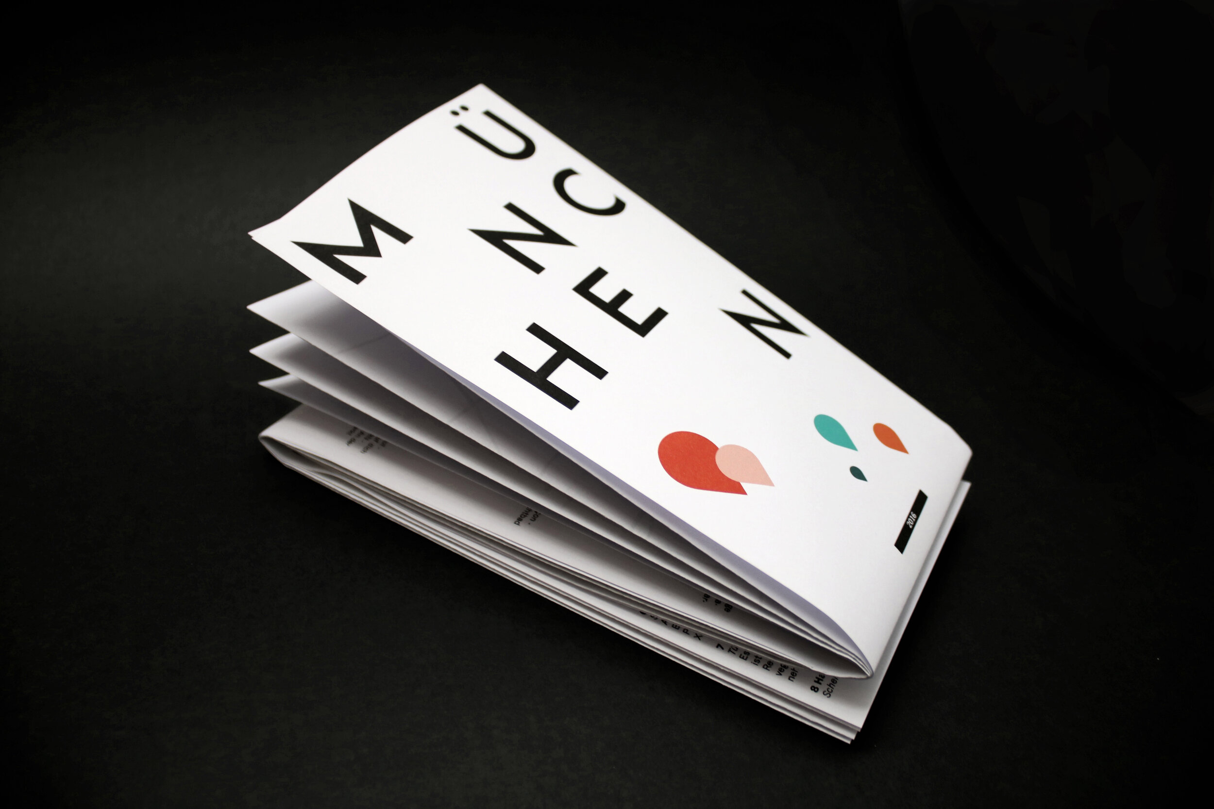
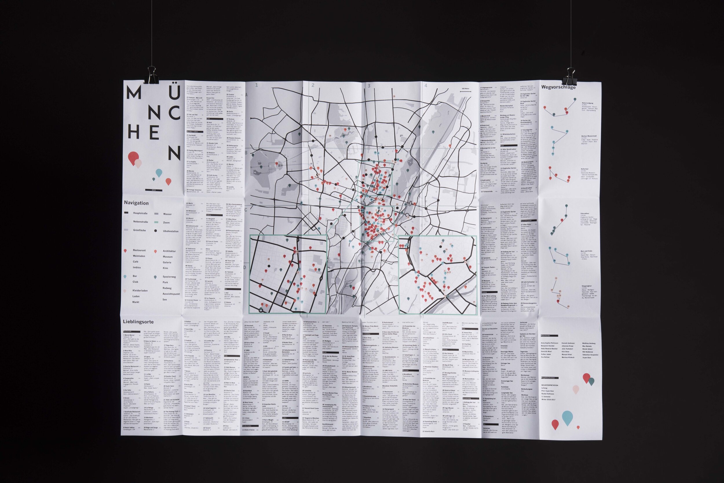
Munich Map
City map
Munich University Of Applied Sciences
Led by : Prof. Xuyen Dam
2016
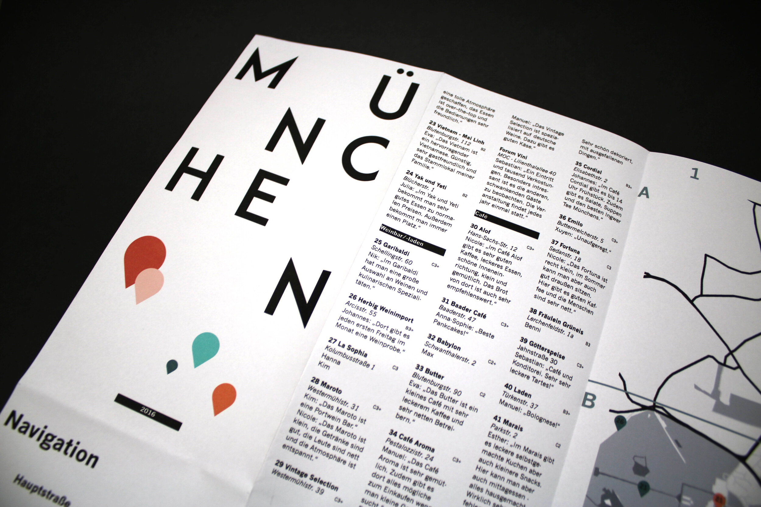
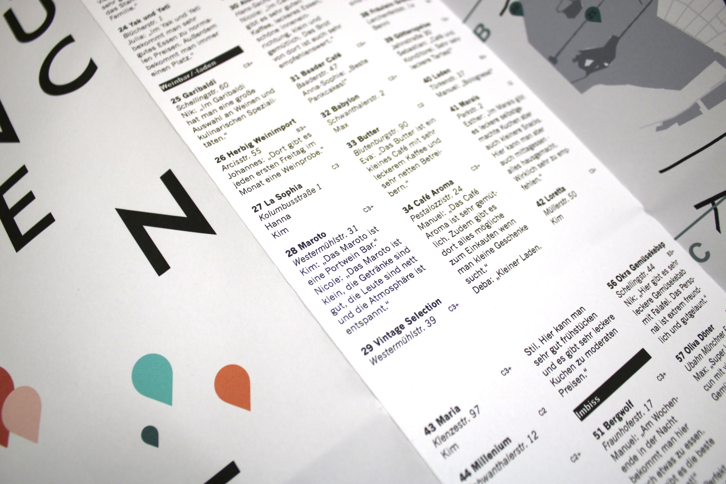
Munich Map is a tourist map of Munich, based on the opinions of young people living in this Bavarian city. In a survey people who know their city very well were able to give personal advice on locations they think should not be missed when visiting the city. “Munich Map” is a social and subjective map, allowing whoever is open to it, to discover and rediscover some extraordinary spots in Munich.
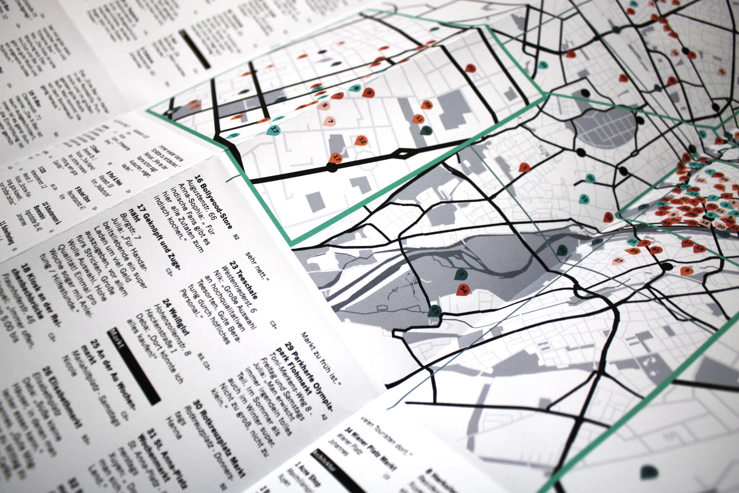
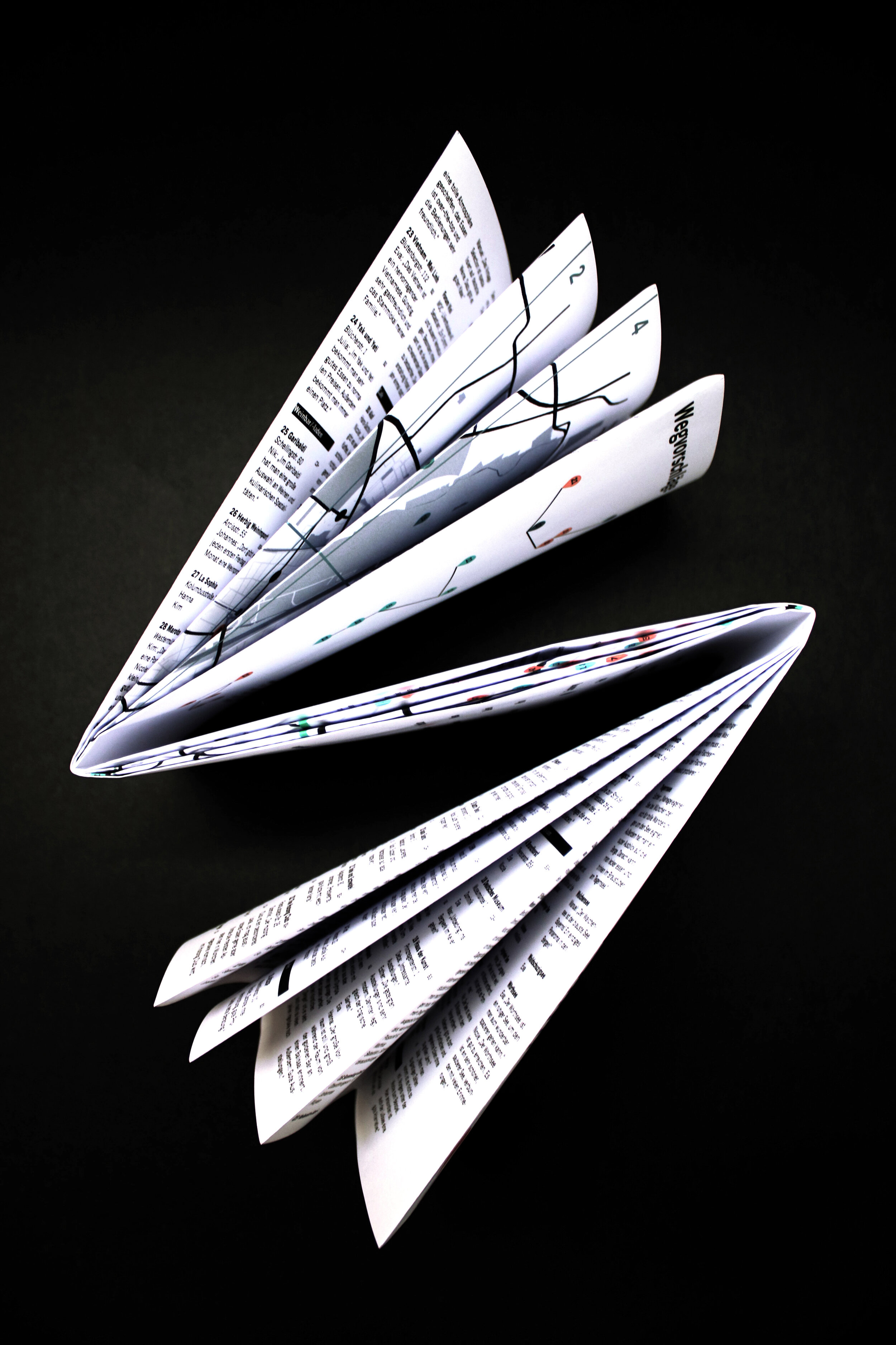
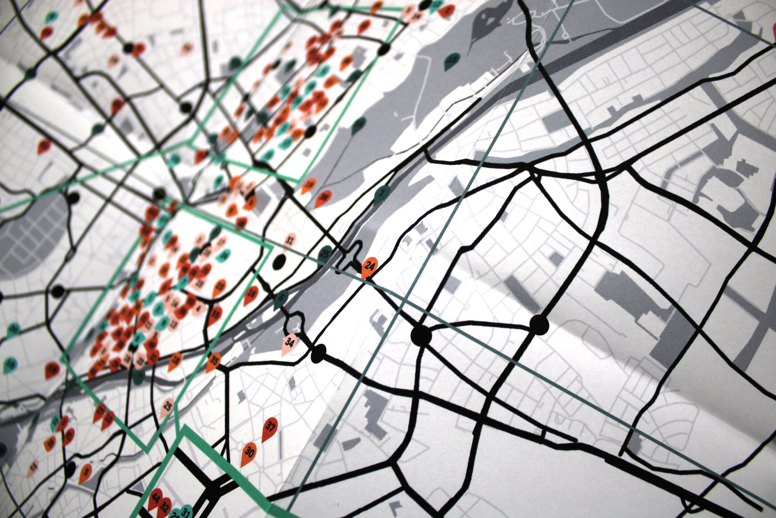
Munich Map is presented as a city map on a reduced scale. A colour code defines specific categories of places, like restaurants, parks, museums, etc.. The composition predetermined by the folding of the plan has been used in order to support the structure and the legibility of this complex information.
The map respresents a source of vast and diversified inspiration where everyone, depending their personal preferences, is able to find something new to discover amongst all the propositions given.This way the map does not only offer people who are new to the city a chance to discover it from its most uncommon side, but also people who might have been living here for years an opportunity to rediscover it from a new angle.